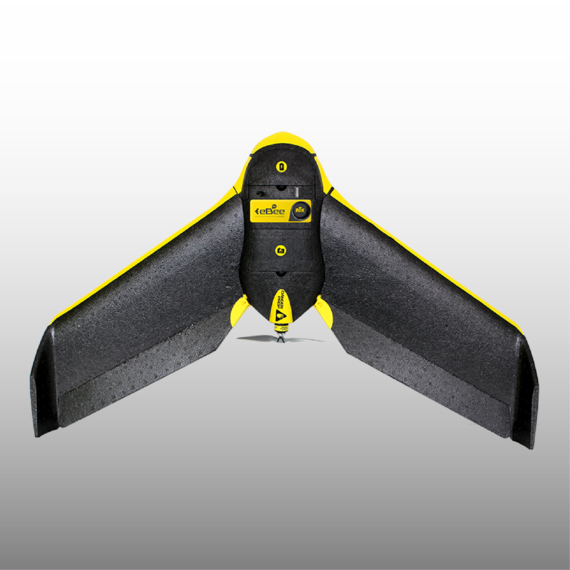
SenseFly Ebee Mapping Drone
Unprecedented survey grade accuracy
Survey grade mapping accuracy is now possible using drone technology and the SenseFly Ebee. Use this fully autonomous drone to capture high-resolution aerial photos that you can transform into accurate orthomosaics & 3D models. Launch: To launch the eBee, shake it three times to start its motor, then just throw it into the air.
The artificial intelligence inside the eBee’s autopilot continuously analyses data provided by the Inertial Measurement Unit and onboard GPS to control every aspect of its flight.
Monitor: Using eMotion ground station software you can view the eBee’s flight parameters, battery level and image acquisition progress in real time.
Control: Made a mistake with your planning? Reprogram your drone’s flight plan and landing point mid-flight. Process: After using eMotion’s built-in Flight Data Manager to pre-process, geotag and organise your flight’s images, simply import these files into professional photogrammetry software, such as Pix4Dmapper Pro.
Then, transform this imagery into geo-referenced orthomosaics, 3D point clouds, triangle models and digital surface models (DSMs).
Trust: With the eBee’s GSD of down to 1.5 cm, relative orthomosaic/3D model accuracy of 1-3x GSD, and absolute horizontal/vertical accuracy of down to 3/5 cm, you can have full confidence in the accuracy of the outputs you produce.The eBee is the easiest to use professional drone on the market, employed by thousands of operators around the world. To launch, just throw eBee into the air! It then flies, captures images and lands itself (but you can alter its flight plan or land manually if required).